
RIEGL presents a groundbreaking LiDAR case study in Hallstatt, Austria, a UNESCO World Heritage Site.
Launched in 2025, the project highlights how RIEGL’s advanced 3D laser scanning technology delivers powerful insights across diverse environments and scales, revealing new dimensions of one of Europe’s most iconic landscapes.
The Hallstatt project was designed to push the limits of LiDAR technology. From steep, hard-to-reach valleys and retreating glaciers to ancient salt mines, archaeological sites, and evolving vegetation, the region presents a diverse array of features for observation. These conditions make Hallstatt an ideal testbed for demonstrating the flexibility and precision of RIEGL’s sensor portfolio.
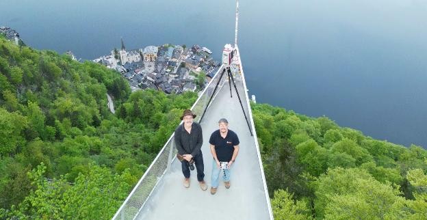
“The world heritage site Hallstatt is a breathtaking place well-known for its long-term history.” said Bernhard Groiss, RIEGL Senior Technical Expert LiDAR Applications. “For the last 8000 years humans have been present mining for salt, facing the everyday challenges of living in a harsh alpine environment and transforming the landscape into a unique cultural heritage site it is nowadays. Recording this place in 3D with all different types of LiDAR sensors developed by RIEGL is first a great honor but also an amazing chance to highlight the capabilities and characteristics of the diverse portfolio of RIEGL´s sensors and their efficient surveying workflows”.
To meet the project’s ambitious goals, RIEGL deployed a combination of airborne and terrestrial LiDAR systems. The RIEGL VQ-840-GE Airborne Bathymetric LiDAR system was utilized to capture high-resolution bathymetric data in Hallstatt’s lakes and shallow water bodies. Its green laser technology enabled precise mapping of underwater terrain, even in areas with dense vegetation or low water clarity, providing critical insights into submerged archaeological features and hydrological dynamics.
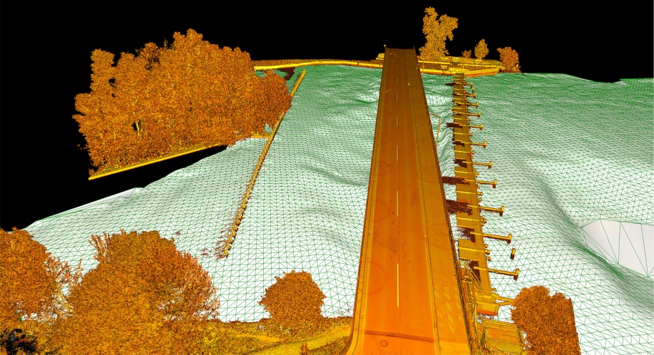
On land, the RIEGL VZ-4000i25 and VZ-600i Terrestrial Laser Scanners were deployed to document the region’s complex topography and cultural landmarks. The VZ-4000i25, with its extended range and high accuracy, was ideal for scanning expansive mountainous terrain and glacial features from a distance. Meanwhile, the VZ-600i offered ultra-high-speed data acquisition and fine detail resolution, making it perfect for capturing intricate architectural and archaeological structures within the historic village and surrounding sites. In this project, the VZ-600i was utilized in both static and kinematic modes, allowing the team to seamlessly transition between tripod-based scanning and mobile mapping workflows to efficiently cover diverse terrain and environments.
RIEGL’s systems were deployed in both static and kinematic modes, operating on the ground and in the air to capture high-resolution data across a diverse range of survey scenarios. This project not only demonstrated the impressive capabilities of each individual sensor but also underscored the strength of RIEGL’s integrated processing strategies. Leveraging precise georeferencing, these workflows enabled smooth data fusion and delivered comprehensive, multi-scale results that supported detailed analysis and visualization.
In today’s fast-paced world, timely access to reliable data is essential. RIEGL’s software tools support streamlined and high-performance processing and analysis, enabling users to generate actionable 3D insights even during field operations. This capability enhances decision-making and ensures that data is readily available for interpretation and long-term archiving