LiDAR
Orbit GT launches new UAS Mapping software at SPAR, Houston
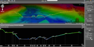
Orbit GT will be launching new UAS Mapping software at the upcoming SPAR event in Houston, USA. “We’re very pleased

Orbit GT will be launching new UAS Mapping software at the upcoming SPAR event in Houston, USA. “We’re very pleased

The second annual Commercial UAV Expo will be held October 31 – November 2, 2016 at the MGM Grand in Las

The Maryland State Highway Administration (SHA), a leader in the implementation of MAP21 performance measures, has purchased another Automatic Road

Teledyne Optech announced the latest addition to its innovative line of airborne laser terrain mappers, the Optech Eclipse. The Optech

Topcon Positioning Group announces a new vehicle-mounted resurfacing solution for paving and milling projects, the SmoothRide system. It uses a

Teledyne Technologies Incorporated and CARIS jointly announced that the CARIS business and its international affiliates (collectively, “CARIS”) have agreed to

The latest version of TerraGo Edge provides full “round trip” support for the Open Geospatial Consortium’s GeoPackage, an open, portable

The Kansas City, Missouri, Police Department has selected an integrated suite of public safety software from Hexagon Safety & Infrastructure

Less than a month remains to register for the 78th FIG Working Week and secure participation in this unique gathering

The expert jury of the Initiative Small and Medium Enterprises under the auspices of the TÜV Nord Group has accorded

Septentrio Americas announces the availability of its new PolaRx5 Continuously Operating Reference Station (CORS) platforms optimized for state DOTs and

The Mobile Cadastral App (a smart mobile solution for cadastral mapping), powered by Supergeo is going to have an international

Leica Geosystems has released a smart, flexible antenna for all GNSS monitoring applications. The Leica GMX910 Smart Antenna. Professionals of

Harness the Power of Maps to Tell Your Story and Win a Trip to San Diego. – Esri Announces 2016

The Northeast Geographic Information Society – NEGIS Spring Conference will be held on April 6-7, 2016 in Amherst, MA (USA).

Teledyne Optech announced that it will unveil a new solution for autonomous 3D mapping at the SPAR 3D expo and

Arithmetica will launch a brand new version of Pointfuse at the SPAR 3D Expo in Texas this month. Pointfuse V2

NCTech announces new measurement capabilities and colorization integration for FARO laser scanners. NCTech, developer of reality imaging systems, announced two

GeoSpatial Experts, specialised in photo-based mobile data collection, announced its reseller partnership agreement with WTH Technology, Inc., a provider of
The new version 6.1 of the PHOTOMOD software family delivers the new dense DSM creation algorithm (SGM), the ability to

Two new Keynotes, Autodesk and NASA will be kicking off SPAR 3D Expo & Conference, which will be held April

Caliper announced that the 2016 U.S. Census Blocks Groups data layer is now available for the entire United States. The

Trimble Unity 3.0 Adds New Features to it’s Smart Water Management Software to Ease Deployment and Connect Mobile Workers to

Blue Marble Geographics announced the immediate availability of version 7.2 of the GeoCalc SDK (Software Development Kit). This powerful toolkit