Airbus Defence and Space
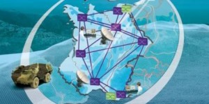
New digital maps for French Ministry of Defence
The IGN has awarded Airbus Defence and Space and Thales the so-called GeoMaps contract to supply the French Ministry of

The IGN has awarded Airbus Defence and Space and Thales the so-called GeoMaps contract to supply the French Ministry of
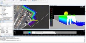
CARIS announced the release of CARIS Bathy DataBASE 4.2. As part of the CARIS Ping-to-Chart solution, Bathy DataBASE is a
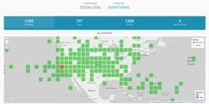
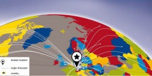
Foundation sees remarkable growth in individual membership program after re-launch while organizational membership of USGIF continues steady rise. The continued
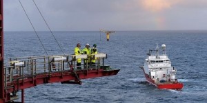
Veripos, a global supplier of high-precision GNSS positioning services to the offshore oil and gas industries, has extended its ranges

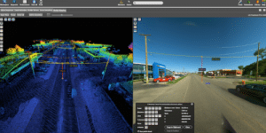
Orbit GT launches the Mobile Mapping Feature Extraction Bundle at the upcoming SPAR event in Houston, USA. “We’re happy to

ASTM International and the Open Geospatial Consortium (OGC) will collaborate on developing and disseminating standards, best practices, and other tools

The newly released Rail-SIT software application is a high performance package for complete railway inspection and analysis. The software is
Esri adds innovative Web Map Analytics Tool to ArcGIS Marketplace. It is now possible to receive analytics surrounding your web
Orbit GT releases the 11.2.4 update for the essential Mobile Mapping product “ Content Manager ”. “We’re happy to announce

Diamond Aircraft Austria has partnered with Gilat Satellite Networks Ltd., specialized in satellite networking technology, solutions and services, to deliver

New software suite enables wider access, visualization and updates to real-time network data. Intergraph NetWorks Extends the Utility Network Model.
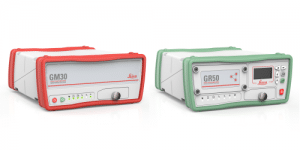
Leica Geosystems announces the latest generation of reference servers and monitoring receiver, optimised with multi-frequency 555 channel capabilities to connect

PCI Geomatics, developer of remote sensing and photogrammetric software and systems, announced the release of its Geomatica 2016. The latest

The Global Spatial Data Infrastructure (GSDI) Association announced that Mark Reichardt, President of the Open Geospatial Consortium (OGC), and Barbara

BARTHAUER is attending the eleventh Pipeline Technology Conference (PTC) in Berlin. In the course of the exhibition, the Braunschweig-based software

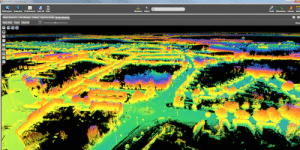
Performed by DMT GbmH & Co. KG, one of the largest ever inner-city 3D surveys came to a successful end

High resolution aerial photography is providing a map of hard to access land, to help the UK’s oldest Wildlife Trust
Orbit GT releases the 11.2.4 update for several products from its Mobile Mapping portfolio. “We’re pleased to announce new versions
The latest version of the geomarketing software RegioGraph is now shipping to customers. Available in English and German, RegioGraph 2016

Racurs company announces a contest of photogrammetric production projects among Russian and international users of PHOTOMOD Lite. There are two

Last week’s sell-out AGI Scotland event once again highlighted the breadth of expertise and interest in the geospatial community in

TerraGo Edge is now available to BAP’s global customer base of forestry, surveying, geology, environmental, scientific and safety organizations. TerraGo

Greg Bentley, CEO of Bentley Systems, Inc. will deliver a keynote on how 3D technology was employed for the Pope’s

1Spatial, a global spatial software company has become a distribution partner of Geocom Informatik. 1Spatial will sell and implement Geocom’s