
3D
Using eCognition to detect solar potential
Earth Imagery and image analysis software help lead more customers to the solar grid. Over the past decade solar’s “hard

Earth Imagery and image analysis software help lead more customers to the solar grid. Over the past decade solar’s “hard

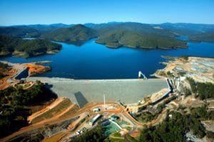
When Rebecca Evans arrived on site for the construction rehabilitation of Virginia’s Todd Lake Dam (TLD), she was certain of
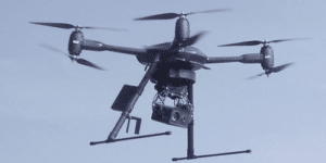
The province of Limburg (Belgium) will soon begin using an Aerialtronics’ drone to assist police and firefighters in tasks such

Delair, a supplier of drone solutions for commercial industries, introduced the next generation of its high-performance Delair DT26X LiDAR UAV,

Striking satellite images reveal the 13 venues where athletes will compete in this month’s Games in South Korea. The games

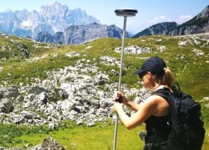
A unique drone (the WingtraOne) helps a team meet the environmental challenges of planning a wind farm in the Alps.

There is no doubt that car technology has moved from one level to another quite dramatically and Google today has
By Fulvio Bernadini After several years in Canada working as a consultant in the world of finance, Guillaume Boye returned

How monitoring technology can be used to assess our future infrastructure assets. ASSET life extension is a particularly popular phrase
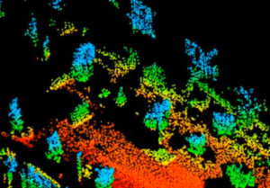
Rockfalls are one of the major treats to the viability and liveability in the Alps. To recognise areas that are
Autonomous cars by 2020 is a good bet—as long as goals across five key criteria are met. The LiDAR market

Phoenix LiDAR are pioneers of the UAV LiDAR industry who continue to push research and development to bring customers surveying

59 per cent of the Netherland’s territory is vulnerable to floods and 26 per cent is below sea level. For
Todd Foster is a man on a mission. For the past six years, he’s been focused on building Queensland-based Milestone

The VAM2 database application, initially developed for Shell USA, is boosting new markets. In 2010, Weiss AG, a German stock
1. How do you see the industry evolving? What are the current trends, and what do you think we

American Engineers, Inc. (AEI) is a full-service surveying and mapping firm established more than thirty-five years ago headquartered in Glasgow,
For thousands of years, sea level has served as an essential, visible physical standard that affects natural and human processes.

Technology develops most successfully when specialists exchange information freely; one of the most unique aspects of this conference is its

Pitney Bowes Inc. announced the global availability of the Li360 Community, an online community for clients, product engineers, partners and

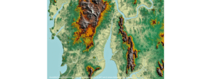
The first country-wide map of relative land motion has been created by a team at the University of Nottingham. Using

Lisa Murray, Director of Commercial UAV Expo, announced the acquisition of Drone World Expo by Diversified Communications, organizers of Commercial

The International Association of Fire Chiefs, the international fire service leader, Intermedix, the global leader of health and safety solutions,

Bentley Systems announced the completion of its CONNECT Edition application portfolio for design, analytical, construction, and asset performance modelling of