
GEOINT 2016
GEOINT 2016 Embraces the GEOINT Revolution
Bringing together more than 3,500 attendees and 265 exhibiting organizations, the United States Geospatial Intelligence Foundation (USGIF) hosted its GEOINT

Bringing together more than 3,500 attendees and 265 exhibiting organizations, the United States Geospatial Intelligence Foundation (USGIF) hosted its GEOINT
The Remote Sensing Laboratory at the National Technical University of Athens, Greece, successfully correlated vegetation indices derived from pan sharpened

“Hamburg has pulling power” – says Prof. Karl-Friedrich Thöne. The venue is perfect for INTERGEO 2016. Why? An interview with

David Southam, Regional Manager Europe North for BIM/CIM and Product Design, talks BIM and Laser Scanning in Construction! Let’s take

The topics being covered are as diverse as the geo community itself, says Hinte Messe, describing the INTERGEO conference programme,
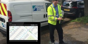
Trimble announced that Sutton and East Surrey Water (SESW) in the U.K. has implemented the Trimble Unity 3.0 software suite
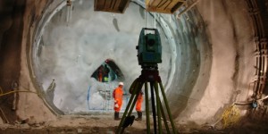
World’s longest and deepest rail tunnel benefits from Leica Geosystems surveying measurement technology. Surveying and monitoring systems made the construction
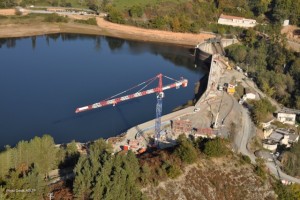
At the Razisse dam on the Dadou River in southwest France, a Spectra Precision FOCUS 35 robotic total station has
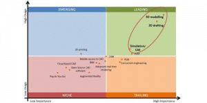
The Business Advantage Group recently announced the results of its annual Worldwide CAD (Computer Aided Design) Trends 2016 Survey ,

A new device based on a single-board computer offers GPS precision to rival professional devices, at a fraction of the

By taking “Smart City” as a key topic, INTERGEO 2016 is focussing on a multi-faceted issue that will shape the
SITECO Informatica srl has developed and implemented an Integrated Road Safety System for the Road Safety Coordination and Monitoring Unit (CReMSS) of

The European Space Solutions event features a 1-day workshop on how the road and traffic management sectors can benefit from

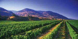
The agricultural policy in the European Union (EU) involves one of the biggest financial transactions in the annual budget. This
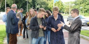
The need for a fundamental understanding of geography is recognized by the Dutch educational system where administrators have established topography
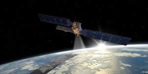
Airbus Defence and Space built C-Band radars will monitor the environment around the clock in all weathers. Copernicus satellite Sentinel-1B

Ordnance Survey is to supply mapping, geographic data and insights to UK Power Networks and Northumbrian Water in a contract

World’s only 3D printer to produce full color, multi-material prototypes and parts in a single3D print. It eliminates time-consuming processes,
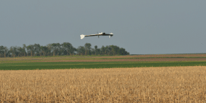
Discover how and why UAVs are set to impact and change the way precision agriculture professionals operate. Farmers and growers

The International Society for Photogrammetry and Remote Sensing organizes its Congresses in quadrennial periods in different countries. XXIII ISPRS Congress

We are moving towards a world where 3D is the expected format, whether it is in games, the cinema or
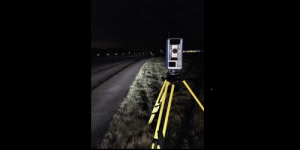
When a topographic survey for the main runway of the East Midlands International Airport was performed during nighttime closure, the
Satellite imagery, content provider and remote sensing spacecraft operator DigitalGlobe is engaging with big data technology, investigating new verticals and
RegioGraph 2016 lets users visualize their customers, target groups and potential on up-to-date digital maps and carry out analyses using