
RIEGL LiDAR Technology for BIM and AEC Applications
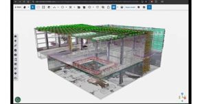
For the first time, RIEGL will be presenting its ultimate surveying solution for the construction sector – the RIEGL VZ-600i

For the first time, RIEGL will be presenting its ultimate surveying solution for the construction sector – the RIEGL VZ-600i

Leica Geosystems, part of Hexagon, announced its latest utility detection solution, the Leica DT100 Precision Locator and Leica DE100 Transmitter.
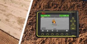
Leica Geosystems, part of Hexagon, and Develon, formerly Doosan Construction Equipment, announced a new aftermarket 3D machine control solution tailored

Esri UK has won Vendor of the Year at the prestigious UK IT Industry Awards 2024. Designed to celebrate the
Avior Geospatial is enhancing its technological capabilities by adding a RIEGL VQ-1560 II-S airborne laser scanning system to their product

Organizers of Geo Week, the leading event that bridges geospatial technologies with the built environment, has announced its conference program
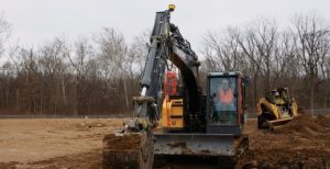
Siteworks Machine Guidance extends the capabilities of Trimble Siteworks Software from surveying and layout to support on-machine guidance and operator

Fugro and Autodesk have partnered and launched Fugro’s GeoDin Ground plugin for Autodesk’s Civil 3D software. GeoDin is a comprehensive
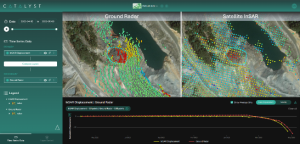
CATALYST, a PCI Geomatics Enterprise Inc. brand, has launched INSIGHTS 2.0, a groundbreaking visualization platform designed to integrate and interpret

FIG and Geospatial Council of Australia, GCA, are pleased to announce the call for papers is now open for the
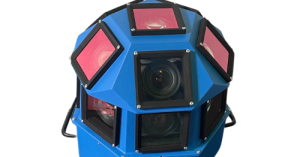
AI-InfraSolutions, a leader in geospatial mapping technology, has partnered with STEMMER IMAGING to develop an innovative 360-degree panoramic camera head

Bentley Systems has announced the winners of the 2024 Going Digital Awards. The annual awards honor the extraordinary work of
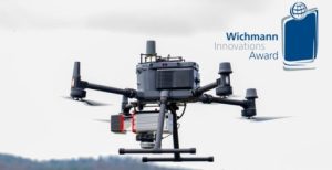
RIEGL is proud to announce winning the Wichmann INTERGEO Innovations Award in the Hardware category with its turnkey system solution

PIX4Dcatch is now integrated with three of the world’s most trusted GNSS systems—Leica Zeno FLX100, Trimble DA2, and TopCon HiPer
Consistently pushing the boundaries of what’s possible in drone mapping, Wingtra is excited to introduce MAP61, the most efficient mapping

Trimble and Worldsensing announced the introduction of a solution for long term 3D ground and structural movement monitoring that will

PIX4Dcatch has been upgraded to offer improved compatibility with the Trimble DA2 positioning service, powered by Trimble Catalyst. This comprehensive

GeoLas Systems announced the launch of the ELMAP-P, a revolutionary airborne LiDAR pod designed specifically for Cessna aircraft models 172,
Virtual Surveyor has significantly reorganized its smart drone surveying software plans with the addition of the Productivity Tools suite to

This collaboration is set to create one of the world’s largest high-precision GNSS positioning service offers for the mass market,

Emlid, the European manufacturer of Reach RTK GNSS receivers, announces updates to its Emlid Flow mobile and cloud app. Upgraded

Leica Geosystems, part of Hexagon, announced the launch of the new Leica iCON trades solution, which includes the Leica iCON
Trimble announced its new Trimble Reality Capture platform service to enable more effective collaboration and the secure sharing of massive

Bentley Systems announced it has acquired 3D geospatial company Cesium. Cesium is recognized as the foundational open platform for creating