
Correlator3D
SimActive Releases Correlator3D Version 10.2
SimActive, a developer of photogrammetry software, announces the release of Correlator3D Version 10.2. This latest version introduces a complete overhaul

SimActive, a developer of photogrammetry software, announces the release of Correlator3D Version 10.2. This latest version introduces a complete overhaul

It brings a host of optimisations and enhancements to Cadcorp SIS Desktop, Cadcorp Cover Modeller, and Cadcorp SIS WebMap. This
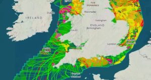
The Crown Estate has won an Esri ‘Special Achievement in GIS Award’ for its innovative programme that helps plan seabed

Leica Geosystems, part of Hexagon, has introduced the new Leica GKP100, a lightweight keypad that can be used with any

This unrivalled global partnership provides a framework for joint business efforts, ultimately enabling both companies to best serve their global

Emlid, the European manufacturer of Reach GNSS receivers, announces an upgrade to its ultralight Reach RX Network RTK rover. The
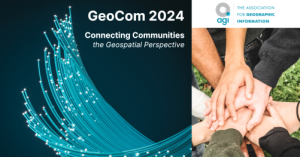
The Association for Geographic Information, the membership group for organisations and individuals working in geospatial, has announced the date and

Aerial Precision announced the launch of its entry-level LiDAR sensor, the AP-LiDAR-M Gen II, and the Aerial Precision app. These
GeoLas is thrilled to announce the release of Geocode 3.0, the latest iteration of its innovative LiDAR processing software. This

The United States Geospatial Intelligence Foundation (USGIF) announced four new members who have been elected to its Board of Directors.

Trimble has introduced the Trimble R980 GNSS system, the newest addition to its Global Navigation Satellite System (GNSS) receiver portfolio.

At a ceremony at this year’s GEO Business event, the Association for Geographic Information (AGI) presented five awards to recipients

NTI Group, Europe’s leading software and service provider to the construction, design, manufacturing and media & entertainment industries, has announced

Hexagon announced the acquisition of Voyansi, an AECO (architecture, engineering, construction and operations) focused provider of BIM (Building Information Modelling)

KOMPASS, a provider of business management software for the geospatial sector, has announced it is offering its solution to the

buildingSMART International announced that Information Delivery Specification (IDS) v1.0 has reached final standard status. This approval marks a significant milestone

Cesium announced new data available on Cesium ion, Japan 3D Buildings. Japan 3D Buildings is a countrywide, open source data

Wingtra announced the launch of WingtraCLOUD, an innovative software designed to revolutionize the way customers expand their drone programs and
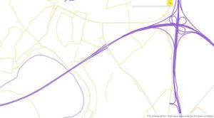
The Open Maps For Europe 2 (OME2) project has announced the first release of a prototype for harmonised large-scale, high-value

Allen & Company, a mapping, surveying, and geospatial services company located in Florida, has announced the creation and launch of

Trimble has opened registration for its 2024 Insight Tech Conference, which will be held September 15-17 at The Venetian Resort

Renowned geographical advocate and advisor to governments, Dr Vanessa Lawrence CB, and eminent climber and author, Stephen Venables, have been

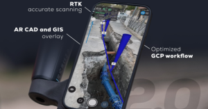
Emlid announces the launch of the Pix4D & Emlid Scanning kit. The kit combines advanced photogrammetry with RTK precision for
Pix4D, a Swiss company and provider of drone and terrestrial mapping and photogrammetry solutions, announces the launch of PIX4Dcatch 2.0.